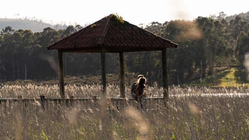
This is an extensive, well-maintained natural space at the mouth of the Ulla River, which links the centre of Catoira with Torres do Oeste and continues as far as the neighbouring municipality of Valga; it thereby follows a section of the Route of the Sea of Arousa and Ulla River. It is made up of a large wetland classified as a Special Protection Area that is included in the Natura 2000 Network. In addition to its considerable scenic values, it also features regular riverside species such as the grey heron, kingfisher, cormorant, salamander, garter snake, the elusive otter, etc. To make it easier to access the area and preserve its delicate ecosystem, a large part of the walk consists of wooden footbridges.
Utilizamos cookies propias y de terceros para mejorar su experiencia y nuestros servicios analizando su navegación en nuestra web y cómo interactúa con nosotros y poder mostrarle publicidad en función de sus hábitos de navegación. Para consentir su utilización, pulse el botón “Acepto”. Puede obtener más información consultando nuestra Política de Cookies.
This website uses cookies to improve your experience while you navigate through the website. Out of these, the cookies that are categorized as necessary are stored on your browser as they are essential for the working of basic functionalities of the website. We also use third-party cookies that help us analyze and understand how you use this website. These cookies will be stored in your browser only with your consent. You also have the option to opt-out of these cookies. But opting out of some of these cookies may affect your browsing experience.