For a long time, it was thought that the name Pontecesures came from the fact that its bridge was built at the order of a Caesar (Pons Caesaris), possibly Caesar Augustus, during a time of clear expansion of the Roman Empire. However, it is more probable that the etymological root is “cessuris” (for passers-by) or even in “censuris,” since the bridge was used to carry out Roman censuses, which facilitated the control of the number of inhabitants or the payment of tributes.
In any case, the bridge has been an essential element in the area’s history and economy from its origin, in the 1st AD, to the present day since it forms part of an important crossroads. With Rome it linked Bracara Augusta (Braga, in Portugal) with Lucus Augusti (Lugo) by means of Via XIX. In the Middle Ages, it connected Santiago de Compostela with the port of Cessuris, Torres do Oeste and Ría de Arousa.
It now links the regions of Pontevedra and A Coruña, directing pilgrims towards Santiago and supporting a high volume of traffic. This gives us an idea of its sturdiness and good condition thanks, in part, to its different renovations, the most important of which was undertaken in the 12th century by Maestro Mateo.
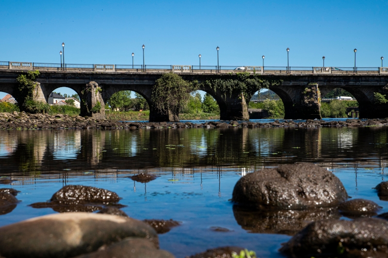
Although we can see twelve arches today, which give it a sturdy, majestic aspect, at the time of its construction the Ulla River was a lot wider and the bridge was even longer.
Utilizamos cookies propias y de terceros para mejorar su experiencia y nuestros servicios analizando su navegación en nuestra web y cómo interactúa con nosotros y poder mostrarle publicidad en función de sus hábitos de navegación. Para consentir su utilización, pulse el botón “Acepto”. Puede obtener más información consultando nuestra Política de Cookies.
This website uses cookies to improve your experience while you navigate through the website. Out of these, the cookies that are categorized as necessary are stored on your browser as they are essential for the working of basic functionalities of the website. We also use third-party cookies that help us analyze and understand how you use this website. These cookies will be stored in your browser only with your consent. You also have the option to opt-out of these cookies. But opting out of some of these cookies may affect your browsing experience.